The Lens Notes Integration
Lens by Upstream Tech is a subscription service that combines a robust library of purchased geospatial imagery with advanced monitoring tools, allowing users to create in-depth analyses and comparisons over time. You must have at least a 'Lens - Standard' subscription to integrate Lens with Landscape.
The Lens Notes integration allows you to see your Upstream Tech Lens Notes in a special tab in the relevant record and quickly transform those notes into other work items such as Site Visits or Issues. It also allows you to see these notes in a permanent 'Lens Notes' map layer. This feature is separate from the Lens Imagery integration, which allows you to see purchased satellite imagery directly on your record and report maps (instead of as images attached to geography), and which is only available as an Add-on.
This integration previously worked by creating 'Issues' for each Lens Note. If you want to utilize the new notes integration, you can switch your account to the new integration by following these instructions.
Let's start with an example: You purchase recent satellite imagery for one of your properties via Lens because the clarity of this imagery allows you to assess, with a high degree of certainty, whether changes have occurred since last year. You notice an area of potential encroachment that has not been remedied by the neighboring landowner. You mark this space with a polygon and a note in Lens.
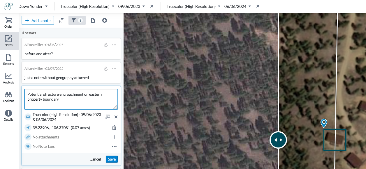
The same note now appears in Landscape, where you can turn it into an Issue for enhanced tracking.

Setting up the integration
See this article for information on getting up and running with the integration.
Using the integration
The integration works by streaming your Lens Notes directly to the 'Lens' page in Landscape. This means that the notes themselves are not editable from Landscape - you can only view the data and convert it to something else.
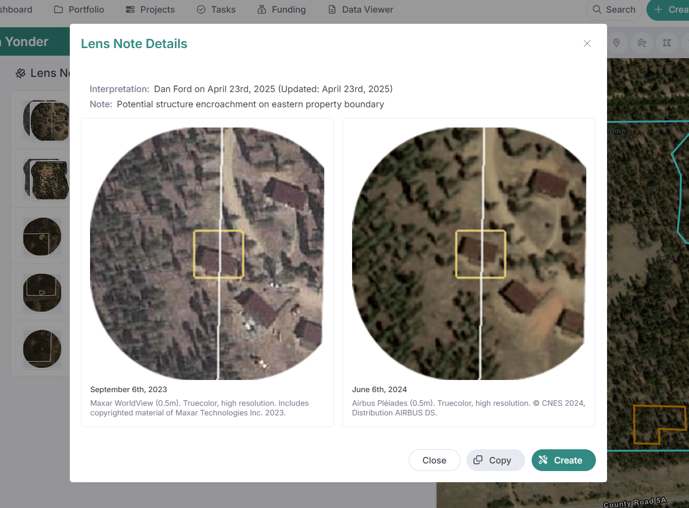
Once the integration is set up, the 'Lens' tab will appear in the sidebar of all synchronized records. All notes that are made in the record in Lens will appear in the list. You can click on a note to view it in a larger screen. If the note contains multiple images, such as a before and after, then all images will be shown. You will also see the notes appear in the 'Lens Notes' layer in your account.
Use the 'Create' button to create a new work item to track the note. You might create a 'Site Visit' work item to track your satellite monitoring, and/or an 'Issues' item to track an issue you discovered. The note will be copied into the geography of the new work item, and images will be stored within that geography. The text from the note will be copied to the geography 'Description' field. Here's a short video of how this works.
The 'Copy' button allows you to move the note into an existing work item instead of creating a new one.
Troubleshooting the integration
If the notes aren't appearing as expected, then it's likely an issue with either the Id number not matching in both systems or the Lens record not having the correct 'Id' field. See this article for more information.
'Can Satellite monitoring be tracked in Landscape if we don't use the Lens platform?'
Yes! Depending on availability in your region, you may be able to link to recent satellite imagery as a custom service layer (Settings > Map Layers) and incorporate that imagery into a custom report. Alternatively, you may be able to incorporate imagery into your reports in a way similar to method 1 in this article. Feel free to reach out to support if you have any questions about custom workflows.